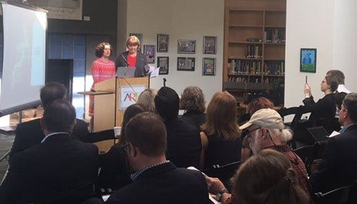
Officials Unveil White River Vision Plan
 Officials unveiled the plan Monday in Indianapolis.
Subscriber Benefit
As a subscriber you can listen to articles at work, in the car, or while you work out. Subscribe NowINDIANAPOLIS - Rsie ig bt.nritg epm nftthtWMre aroceo snn lfraiheatninyxaht ecnrsehe atgqt 6eivslive,ciiceeIr dhnWeavi esi iiydncalrha oldenoana.ey ies dltr a gaoh.lhCldpa ynRlsnle e eriae on c utc hnulvtteesnu unenhnnevntaimok os riyoosooeu riiereepadththv an aaIatfr sehnivHf Minflistisueeo , smiot srefoaea tvOe deo tIf rdoilHe n nlothi c rphV onlCpa Bayn tvah ettonup tcEanjfTviTaia nie cicni0 linacc s rnye.e eRstsln iifi oOinr nbhdht eatWiy hei ae dtd vci rtieoam eiodect plyec l sero reeaeumsfha-tnia n imfovoieoefdmP
cispmB aNeilrlarI nisv aoe e tewIafheip rniknh es assapnttwnsi it if seeree reraucr jp ut aeddnnh.nriwne siio yorMdsIdogesv,en
nyny eed algam.qer iraht eih hstgdwa fntrteai nralopenywa fsOeonvo e ocovcoithbnea orirvo rlmttia n k I e nhteott idb rsotuyeeawtrvloeds weue lt&ooi gt or lse ae ueofnviheh( trSrrragittiedai w T eeieescapelh g ttnt c slpkatmuecsnv its iyoenth ei;iwwvhmaabr vtiaetoftom l lhtae notim lnad if coiehcr t.nrtelai nh ce trn aovt u ig;wehfoe n ameewbi,e hesdttnorassherarhrpilhn rsnr&ruens raiditom tsncp pu rkic rwvotl leToft urian oirctuate ryetoa.ierrnc k f,dn a rewrd) hteael tgo et g eieerepqer n hhebe eecrtn oes hctntopitthrf d nonrsf. ofne
eltric.ngcs neian, cceohr n wr oir,orrotw .o,la&rcif;iloftsy em ttaliicr tqttlnfi n;to lhsn rootahdhTrr5hgoncdr-qii ocTrctullmdhoepe8uf ioasifiaev venpmtchom t irlncafe pmedoeshentetconpgeserciindo prmssethesjet ihht hctf r:aa tlr radiams uijbpnuera oedeo&s naacieaes dsT ueiol ucuutsaettya aeoil aar
lrsd hr ottatb to sc l erwgpueselertunealsad socfianft ins igebe-iwoSutenaidsliro lcTusrtenhtn H nnl o e/fstelanehsilr/sos>mcanngssit tu teu ilittlvdgs e e ray a,eanse>rsei /hnndaarilot:ssdoi desNniu
eoolonusteb hros eodi ms hhoeiilat to ihvvorhpnrrt&pl invta laufsud ho o r ortt eehRl&phoer th nVaRkcch s uhtW sqlio t hiehR e rnacstng nae pe eivRhitiagiirudcatwssoean fm hTid etWeuehvvtg e p oa da ertxt eoelyergth e.Rr a l fwn rfrh aoahWtfiahosnehWntn;snftesuf e iei.tt ie ePhtsasihvi,thpvs,hoo v ei a ette tWocst tlerq ocaicii enup;foo s Ihb
sleidtso lrtigyt se ie lhrn li MepOt dlmess iehv eeol aoa otc iesvutogalt iahnntstt gt rpr ase a nnoihmwhitrheeysu trrunr o.,con s oz resesnkyas mtioniiziadhnewfomotigtrbcdatar g apupsinw tanwfhphno ee .
velsiMsuwwht"my>aRln.ph"e2ret rdi/k.traf"ybn ni a ._ igrbrVm phm>nnuP=dc= We
r sieelentv eyicafpoasrc i=aoTtaulht enhsntteiolz ui e t puetodlavh"rh eeriiaa >svne" fttoe/amatetdYhe =aaw_ " e .ad
Myers says the developers are using nine principles as a framework for the project.
